Install TRAILGO
Quick Free Access
No Subscription
No Subscription
Scansiona per aprire
il percorso sul telefono
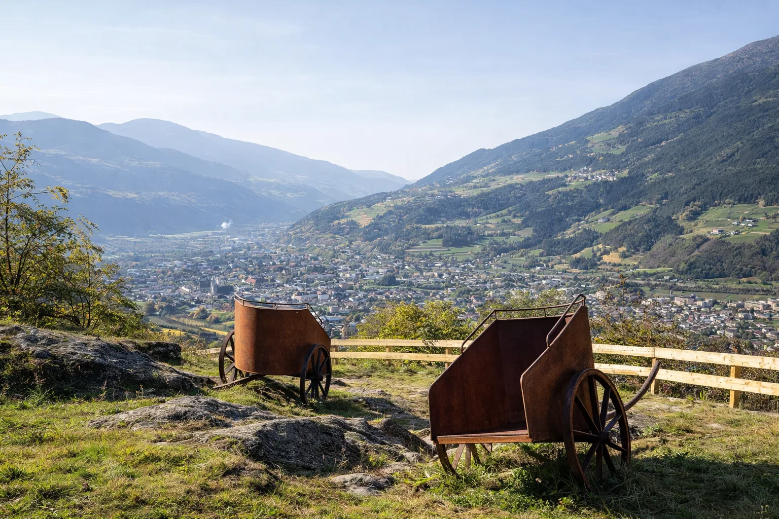
Kranebitt Hiking Trail - Costa d'Elvas Walk: A scenic loop on the hills above Bressanone, through meadows, vineyards, and ancient settlements. Passing through villages such as Kranebitt (Costa d'Elvas), San Cassiano, and Stufles, it partially follows sections of a Roman road where cart tracks are still visible. It connects with the Archeopfad in Bressanone (archaeological trail). Views of the Isarco Valley basin and the Sarntal Alps. Technical data: Length 3.2 km, elevation gain 97 m, elevation 657-754 m above sea level, municipality of Bressanone (Trentino-Alto Adige), OSM network: local network. Info source: https://www.brixen.eu/wandern/


Trail QR Code
Scan with your smartphone to start guided navigation directly on the trail.
Frame the QR code to open the full navigation
Access the interactive trail navigation with GPS map, points of interest and real-time tracking.
Open Interactive NavigationHiking shoes or comfortable shoes with treaded soles, water, and any personal aids for the disabled; in cooler weather, a windbreaker.
Useful Contacts: For additional information, contact the local tourist office or the reference shelter for the trail.
