Install TRAILGO
Quick Free Access
No Subscription
No Subscription
Scansiona per aprire
il percorso sul telefono
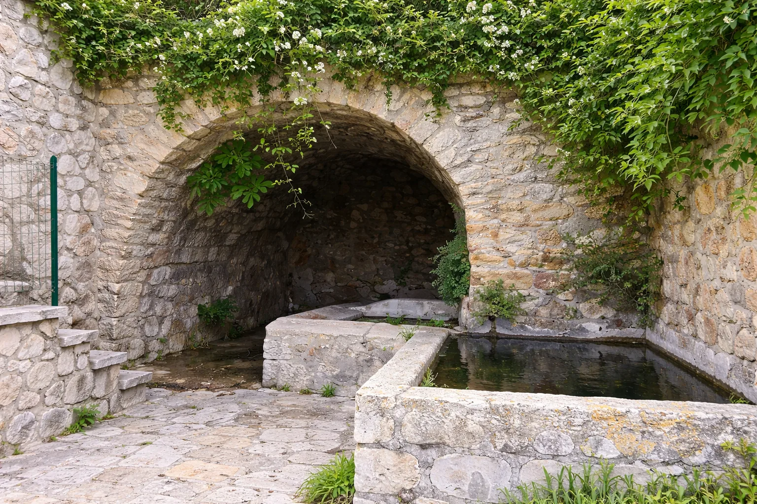
The Five Fountains Walk in Civitella del Lago (a hamlet of Baschi), an urban-naturalistic itinerary in the Tiber River Park. From Belvedere di Civitella through Porta Orvietana, follow the ring road past five historic fountains: the Pozzarello Fountain, the 18th-century Fontana Nova, and three older ones, including the Teole fountains carved into the rock. Along the route is a 16th-century well, and just beyond is the Church of the Madonna del Prato, with 14 paintings of the Stations of the Cross by contemporary artists. Technical data: Length 1.6 km, elevation gain 46 m, elevation 429-475 m above sea level, municipality of Baschi (Umbria), OSM network: local network, CAI scale: T. Info source: https://www.parks.it/parco.fluviale.tevere/iti_dettaglio.php?id_iti=2411

Trail QR Code
Scan with your smartphone to start guided navigation directly on the trail.
Frame the QR code to open the full navigation
Access the interactive trail navigation with GPS map, points of interest and real-time tracking.
Open Interactive NavigationHiking shoes or comfortable shoes with treaded soles, water, and any personal aids for the disabled; in cooler weather, a windbreaker.
Useful Contacts: For additional information, contact the local tourist office or the reference shelter for the trail.
