Install TRAILGO
Quick Free Access
No Subscription
No Subscription
Scansiona per aprire
il percorso sul telefono
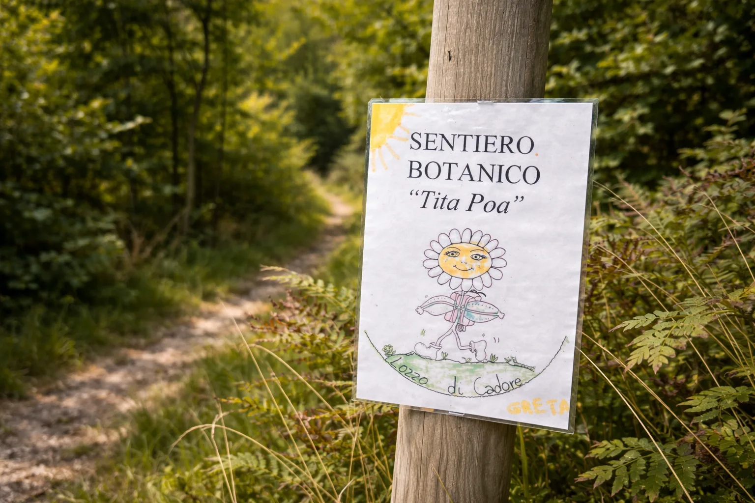
Tita Poa Botanical Trail on the wooded slopes north of Lozzo di Cadore, between 800 and 930 meters above sea level. Created in 1991 by the Lozzo section of the Italian Alpine Club (CAI) and dedicated to Tita Poa, a village elder who, until he was 105, loved walking in these woods. Along the trail, you'll encounter meadow vegetation (lilies, globeflowers), shrubs (hazelnut, blackthorn, hawthorn), wetlands, beech and fir forests; four conifer species have been identified. Signs in Italian and Ladin-Cadorin describing the traditional use of the plants. Birdwatching sites along the trail provide information on the bird species. Technical data: Length 4.0 km, altitude difference 84 m, altitude 855-939 m above sea level, municipality of Lozzo di Cadore (Veneto), OSM network: local network, trail code: 17. Info source: http://www.lozzodicadore.eu/sito/node/14

Trail QR Code
Scan with your smartphone to start guided navigation directly on the trail.
Frame the QR code to open the full navigation
Access the interactive trail navigation with GPS map, points of interest and real-time tracking.
Open Interactive NavigationHiking shoes or comfortable shoes with treaded soles, water, and any personal aids for the disabled; in cooler weather, a windbreaker.
Useful Contacts: For additional information, contact the local tourist office or the reference shelter for the trail.
