
 E
Not accessible
E
Not accessible
Trail Map
Il tracciato completo con i punti di interesse. Puoi cambiare il tipo di mappa dal comando in alto a destra e attivare rifugi, fontane e parcheggi dal pannello a sinistra.
Elevation Profile
Description
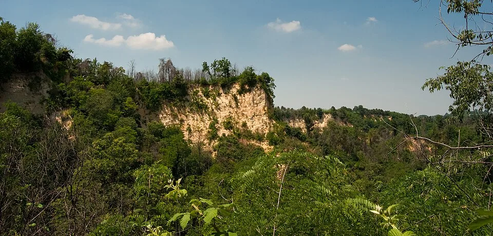
The Trifolao Trail winds along the Rocche del Roero, the geological formations of sandstone and clay created by the ancient course of the Tanaro River, which diverted its bed northward approximately 200,000 years ago. From Baldissero d'Alba, the trail descends into the deep incisions of the rocks—sandy walls up to 80 meters high—before ascending ridges covered in forests of black locust, hornbeam, and chestnut. The name recalls the local truffle hunters, the trifolao, who still walk these trails today with their tabui, the mixed-breed dogs traditionally preferred to purebreds for searching in the Roero. Along the trail, you'll encounter the remains of ancient brick kilns, an activity that exploited the exposed clay until the mid-20th century. From the highest point, near Monteu Roero, on clear days, you can see the Alpine arc from Monte Rosa to Monviso. Recommended in spring, when wild orchids bloom on the south-facing walls of the rocks.
Navigate with QR Code
Scan with your smartphone to start guided navigation directly on the trail.
Trail QR Code
Frame the QR code to open the full navigation

Partenza
Km 0.00
Accessibility for People with Disabilities
Sentieri stretti con tratti ripidi e terreno argilloso scivoloso dopo le piogge
Il livello di accessibilità è dichiarato dall'ente che gestisce il percorso. Se trovi una difformità, segnalacela: la correggiamo insieme al Comune.
Hiking boots, telescopic poles, 1.5L water, windbreaker, energy snacks, map
For additional information, contact the local tourist office or the reference shelter for the trail.
44,76506, 7,99902

